
| 779 kmGPS distance | 4 ridesRecorded days | 6 departmentsGard to Rhône | 1,505 mHighest point | 43 km/hAvg moving speed | May 2026When we rode |
Late May 2026 took us from Port Camargue up through the Gard and the Ardèche gorges to Lyon, with a different road home five days later. The GPS recorded four rides — two on the way out, 22 and 23 May, and two on the way back, 27 and 28 May — adding up to 779 km and about 8,330 m of climbing.
No track was recorded between 23 and 27 May, so this post covers the four days we do have. Each day below has its own stats, a map of the track with the towns we passed, and an elevation profile. Gold dots on the maps are the longer stops; click or tap them for the time.
Out through the Ardèche gorges, over the Pilat to Lyon — and back by the high plateau of Les Estables.
Day 1 — Port Camargue to the Ardèche Hills (22 May)
| 238 kmDistance | 5 h 24Ride time | 44 km/hAvg moving speed | 2,448 mClimbing | 1,133 mHighest point |
Friday 22 May started at 09:09 from Port Camargue and went north-west across the Hérault–Gard border: Marsillargues, Sommières, then Gajan and Saint-Jean-de-Ceyrargues in the garrigue. A 14-minute stop near Brignon at 73 km and a 25-minute one near Seynes at 94 km broke up the first morning.
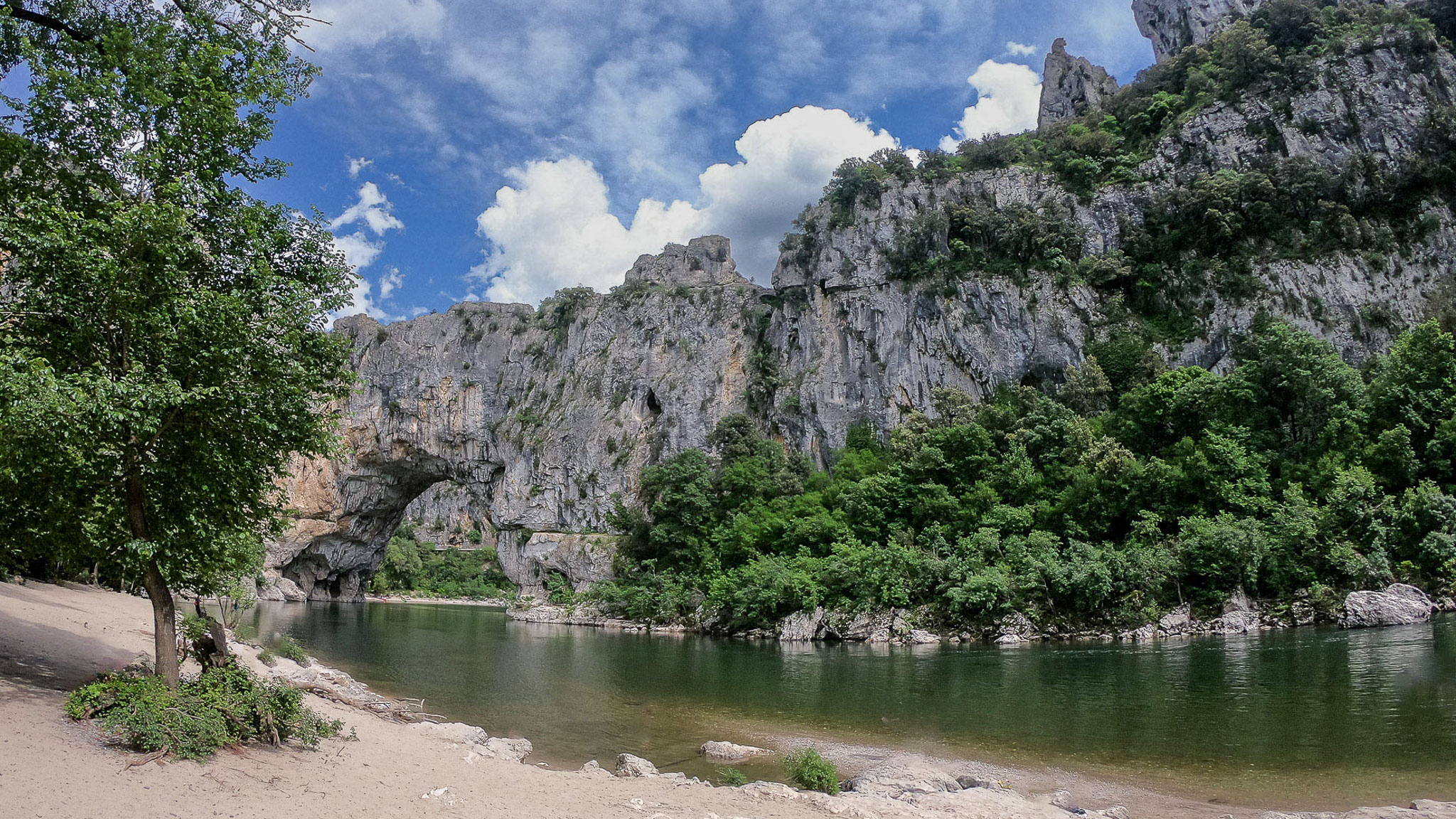
The middle of the day was the Ardèche. We crossed to Aiguèze above the gorges and stopped for lunch at Saint-Martin-d'Ardèche, where the GPS shows 93 minutes from 12:37 at about 100 m. After that the road follows the gorges north: Saint-Remèze (the drone went up at around 310 m, a series of short stops at 157 km), Vallon-Pont-d'Arc, Ruoms and Balazuc.
The last stretch climbs out of the valley — through Ucel and the Vallées-d'Antraigues area, with a 10-minute stop at about 640 m — to finish at 17:57 in the hills near Mézilhac, with 238 km and about 2,450 m of climbing behind us. The day's high point is roughly 1,133 m.
| 🏡 | Night 1 — Airbnb in Mézilhac, Ardèche Our stop on the way to Lyon, in the hills where the Day 1 recording ends. A wonderful stay with our host Isabelle, and a bonus for riders: private parking at the back for the bike. View the listing → |
Day 2 — Over the Pilat to Lyon (23 May)
| 168 kmDistance | 3 h 40Ride time | 46 km/hAvg moving speed | 1,834 mClimbing | 1,243 mHighest point |
Saturday started early: 07:56 from Le Chambon, in the Ardèche hills where the previous day had ended. Saint-Cierge-sous-le-Cheylard came first, and then Saint-Agrève on the high plateau, where we stopped for 34 minutes at about 1,115 m.
From there the route runs north-east through Montregard and Saint-Sauveur-en-Rue to Bourg-Argental (a 15-minute stop at 643 m), then Saint-Julien-Molin-Molette and Chuyer on the edge of the Pilat massif.
The last leg drops towards the Lyon area through Saint-Maurice-sur-Dargoire and Soucieu-en-Jarrest, ending at Vaugneray at 12:47 after 168 km. The GPS kept running for another five hours or so, which is why the elapsed time on the app is so much longer than the ride time here.
| 👨👩👧 | Nights 2–5 — Lyon, with family In Lyon we stayed with relatives and spent the days visiting family and friends. |
Day 3 — Lyon Back Towards the Ardèche (27 May)
| 206 kmDistance | 4 h 27Ride time | 46 km/hAvg moving speed | 2,685 mClimbing | 1,505 mHighest point |
The return started on Wednesday 27 May at 09:35 from Craponne, west of Lyon. The big day of the four: 206 km and about 2,680 m of climbing, the most of any day in this post.
We went south through Les Haies to Pélussin in the Pilat park (a 46-minute stop at 513 m), and across to Bourg-Argental. From there the road climbs into the Haute-Loire: Riotord, then Tence, where the GPS shows a run of short stops between 13:04 and 14:25 (at about 930–1,070 m).
The afternoon was the high plateau: Mazet-Saint-Voy, Les Estables at about 1,380 m (the day's highest point is 1,505 m), then down through Lachamp-Raphaël and Laviolle in the Ardèche to finish at Aizac at 16:18.
| 🏡 | Night 6 — Airbnb in Antraigues-sur-Volane, Ardèche On the way back we stayed on the main square of Antraigues-sur-Volane, the village of Jean Ferrat, close to where the Day 3 track ends at Aizac. A beautiful all-stone apartment right on the square. Self check-in, which we do not usually favour, and no private parking for the bike, but it was safe. View the listing → |
Day 4 — Down the Ardèche and Home (28 May)
| 168 kmDistance | 4 h 45Ride time | 35 km/hAvg moving speed | 1,359 mClimbing | 822 mHighest point |
Thursday was the slowest day on paper — 35 km/h moving speed — and the longest at the table. We left Aizac at 09:26 and went through Champagne and Jaujac, with a 17-minute and a 16-minute stop in the first 26 km, then a 64-minute lunch at Largentière from 11:56.
After Largentière the road drops out of the Ardèche through Rocher, Lablachère and Saint-Paul-le-Jeune to the Gard: a stop near Brouzet-lès-Alès, then Navacelles and Souvignargues. A final 74-minute break at Marsillargues, and the track ends at Le Grau-du-Roi at 17:37 with 168 km and about 1,360 m of climbing.
The Whole Trip on One Map
All four recorded days together: the two outbound days from the coast to Lyon, and the two return days. Switch the basemap with the layers button, and zoom in to see the smaller villages.
Villages Worth Stopping For
These are places the track actually passes or stops at, in the order we met them.
A town on the Vidourle with a Roman bridge and arcaded old streets, a natural first town on the road out of the coast.
On the ride: Day 1, about 40 km into the ride.
A village of golden stone perched above the Ardèche gorges, listed among the Plus Beaux Villages de France. Its ramparts look straight down on the river.
On the ride: Day 1, just before lunch at Saint-Martin-d'Ardèche on the other side of the river.
Where the Ardèche river reaches the Rhône, at the mouth of the gorges. A lunch stop with the river on one side and the plateau on the other.
On the ride: Day 1, a 93-minute lunch stop starting 12:37, at about 100 m.
A medieval village on a rocky spur above the Ardèche river, another of the Plus Beaux Villages de France, with steep stone lanes and a view down the valley.
On the ride: Day 1, in the afternoon, between Ruoms and the climb out of the valley.
A town on the high plateau of the Haut-Vivarais, at over 1,000 m. The air is noticeably cooler and the landscape much more open.
On the ride: Day 2, a 34-minute stop at about 1,115 m.
A small town in the Parc naturel régional du Pilat, on the slopes above the Rhône valley.
On the ride: Day 3, a 46-minute stop at about 513 m.
One of the highest villages in the Massif Central, near the Mézenc massif, at roughly 1,350 m. The high plateau around it is bare and wide.
On the ride: Day 3, a short stop at 161 km, at about 1,380 m on the GPS.
An old town in the Ardèche hills whose name recalls the silver mines nearby. The narrow lanes of the old town sit below the château.
On the ride: Day 4, a 64-minute lunch stop at about 270 m.
Ride Card
| 22–28 May 2026 from Port Camargue | |||
|---|---|---|---|
| Distance | 779 km (GPS, 4 days) | Riding time | 18 h 16 excl. stops |
| Avg speed | 43 km/h moving | Climbing | ≈ 8,330 m |
| Highest point | ≈ 1,505 m (Day 3) | Longest day | Day 1 — 238 km |
| Departments | Gard, Hérault, Ardèche, Haute-Loire, Loire, Rhône | Best season | Late spring and autumn |
| Drone spot | Near Saint-Remèze (310 m), marked on the map | Bike | Triumph Tiger 900 |
Practical Information
| Route out | Port Camargue → Sommières → Aiguèze → Saint-Martin-d'Ardèche → Vallon-Pont-d'Arc → Balazuc → Le Chambon → Saint-Agrève → Bourg-Argental → Lyon area |
| Route back | Craponne → Pélussin → Bourg-Argental → Tence → Les Estables → Aizac → Largentière → Navacelles → Marsillargues → Le Grau-du-Roi |
| Altitude | The plateau around Saint-Agrève and Les Estables is above 1,000 m; the highest GPS point of the trip is about 1,505 m. Pack a warm layer even in late May. |
| Not recorded | No track from 24 to 26 May, so those days are not in the numbers. |
| How the numbers work | Distance, speed and climbing come from the GPS track. Ride time excludes stops of five minutes or more, and climbing is smoothed, so treat it as an estimate. |
| 🏍️ | Day 3 is the one to copy: the Pilat, the Haute-Loire plateau and Les Estables in one ride, with a long break around Tence. Start early — we left at 09:35 and finished at 16:18. |
| ← Previous rideSaint-Guilhem-le-Désert by Motorcycle — A May Day Ride | Next ride →Briançon & the Col d’Izoard by Motorcycle — June 2026 |