
| 195 kmGPS distance | 1 dayDuration | 2 departmentsGard and Hérault | 378 mHighest point | 52 km/hAvg moving speed | May 2026When we rode |
A day ride from Port Camargue on Friday 8 May 2026: out through the Hérault to the gorges around Saint-Guilhem-le-Désert, back across the limestone plateau north of Montpellier, and home through the Camargue edge. The GPS adds up to 195 km and about 980 m of climbing — a short loop by our standards, with a long lunch in the middle.
Below you'll find the track on a map, an elevation profile, the places we passed and a ride card for planning your own version. Gold dots on the map are the longer stops; click or tap them for the time.
The shape of the day: two hours riding in, a 130-minute stop at the foot of the gorges, then the plateau road home.
The Ride: Port Camargue to Saint-Guilhem-le-Désert and Back
| 195 kmDistance | 3 h 45Ride time | 52 km/hAvg moving speed | 984 mClimbing | 378 mHighest point |
We left Port Camargue at 11:24 and headed north-east across the flat land around the Étang de l'Or: Mauguio, then Saint-Aunès and Saint-Gély-du-Fesc on the northern edge of the Montpellier area. From there the road climbs into the garrigue towards Puéchabon, where the GPS shows a nine-minute pause at about 300 m.
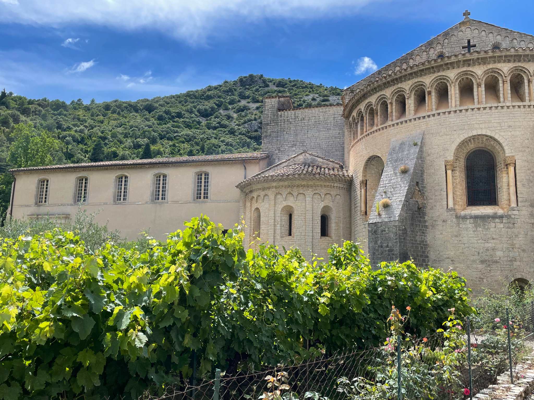
The big stop came at 93 km: 130 minutes at Saint-Guilhem-le-Désert, between 13:07 and 15:17, at an altitude of about 150 m in the Gorges de l'Hérault. The GPS recorded it as one long pause, which is why the ride time below is well under the elapsed time.
The way back goes over the Causse de la Selle plateau — a 15-minute stop near Causse-de-la-Selle at 111 km is where the drone went up — then Saint-Martin-de-Londres, Assas and Valergues, before the Camargue edge at Saint-Laurent-d'Aigouze and the final run into Le Grau-du-Roi at 18:18.
Villages Worth Stopping For
These are the places the track actually passes or stops at. For each, I've said where it falls in the ride.
A village of stone lanes at the mouth of the Gorges de l'Hérault, built around the Abbey of Gellone, founded in 804. The abbey is part of the UNESCO-listed Routes of Santiago de Compostela in France, and the nearby Pont du Diable is a short drive away.
On the ride: The long stop of the day: 130 minutes starting around 13:07, at about 150 m.
A small village on the limestone plateau that separates the Hérault valley from the Hortus and Saint-Loup country. The plateau road is wide open and quiet.
On the ride: A 15-minute stop at 111 km, where the drone went up.
A small town at the edge of the causse, with a Romanesque church as its landmark and a few cafés on the main street.
On the ride: Passed at around 120 km on the way home.
On the shore of the Étang de l'Or lagoon, east of Montpellier. The landscape is flat and open, with the sea air close by.
On the ride: Our first town after Le Grau-du-Roi, about 20 km into the day.
Ride Card
| 1 day from Port Camargue — 8 May 2026 | |||
|---|---|---|---|
| Distance | 195 km (GPS) | Riding time | 3 h 45 excl. stops |
| Avg speed | 52 km/h moving | Climbing | ≈ 980 m |
| Highest point | ≈ 378 m | Elapsed | 11:24 → 18:18 |
| Departments | Gard, Hérault | Best season | Spring and autumn |
| Drone spot | Near Causse-de-la-Selle (157 m) | Bike | Triumph Tiger 900 |
Practical Information
| Route | Le Grau-du-Roi → Mauguio → Saint-Gély-du-Fesc → Puéchabon → Saint-Guilhem-le-Désert → Causse-de-la-Selle → Saint-Martin-de-Londres → Assas → Saint-Laurent-d'Aigouze → Le Grau-du-Roi |
| Time | Left 11:24, back 18:18. Over half of the elapsed time was stops, including 130 minutes at Saint-Guilhem-le-Désert. |
| Altitude | Low and gentle: the highest GPS point is about 380 m, and the day's climbing is rolling rather than sustained. |
| How the numbers work | Distance, speed and climbing come from the GPS track. Ride time excludes stops of five minutes or more, and climbing is smoothed, so treat it as an estimate. |
| 🏍️ | This is a good first ride of the season: nothing high, nothing remote, and a lunch stop that makes the day. Aim to arrive at Saint-Guilhem-le-Désert before the lunchtime crowds. |
| ← Previous rideVerdon & Sisteron by Motorcycle — Four Days from Port Camargue | Next ride →Ardèche & Lyon by Motorcycle — May 2026 |