
| 485 kmRecorded distance | 5 daysDuration | 7 departmentsGard to Var | 2,449 mHighest point | 54 km/hDay 1 avg speed | Jun 2026When we rode |
Five days in the Alps in late June 2026: north through the Vaucluse and the Drôme Provençale to Laragne-Montéglin, up the Durance past Serre-Ponçon to Briançon, a long loop over the Col d'Izoard and the Ubaye, then the Verdon on the way home. The GPS recorded the first three days — 485 km in total — and the last two are shown here as the routes we planned.
Each day has its own stats, a map of the track with the places we passed, and an elevation profile where we have one. Gold dots on the maps are the longer stops; click or tap them for the time.
Day 3 in one line: 171 kilometres, the Col d’Izoard before 10 a.m., and a thunderstorm at Colmars.
Day 1 — Port Camargue to Laragne-Montéglin (20 June)
| 234 kmDistance | 4 h 19Ride time | 54 km/hAvg moving speed | 1,672 mClimbing | 1,262 mHighest point |
Saturday 20 June was the fast one: 234 km at an average of 54 km/h while moving, the quickest day of the trip. We left Le Grau-du-Roi at 07:28, crossed the Petite Camargue to Saint-Laurent-d'Aigouze and Arles, and stopped for 14 minutes near Beaucaire at 68 km.
North of the Alpilles the route runs through Saint-Étienne-du-Grès and Plan-d'Orgon to the Sorgue country: L'Isle-sur-la-Sorgue and a 20-minute stop at Velleron at 09:57. Then it climbs into the Vaucluse hills — Malemort-du-Comtat, Monieux at the edge of the Gorges de la Nesque, and Saint-Trinit on the Plateau de Sault.
The Drôme Provençale and the Hautes-Alpes finish the day: Séderon, Barret-sur-Méouge and the arrival at Laragne-Montéglin at 12:26, with about 1,670 m of climbing and a high point of roughly 1,262 m.
Day 2 — Serre-Ponçon, Embrun and Briançon (21 June)
| 80 kmDistance | 1 h 53Ride time | 42 km/hAvg moving speed | 1,167 mClimbing | 1,293 mHighest point |
Sunday's recording picks up at 13:40 at Rousset, on the shore of the Lac de Serre-Ponçon, so the first part of the day, Laragne-Montéglin to the lake, is not in the numbers. The dashed line on the map is the planned route from our KML file for that stretch, about 49 km, so it is approximate. From there it is 80 km to Briançon.
We stopped for 44 minutes by the lake at about 838 m, then followed the Durance up through Prunières to Embrun, where the GPS shows two short stops (8 and 19 minutes) at about 910 m. The valley road continues through La Roche-de-Rame and climbs steadily to Briançon.
We arrived in Briançon around 16:51, at about 1,280 m. The day's moving speed is a modest 42 km/h, which says more about the stops than the road.
Day 3 — The Col d’Izoard and the Ubaye (22 June)
| 171 kmDistance | 7 h 15Elapsed | 24 km/hAvg overall speed | ≈ 3,600 mClimbing | 2,449 mHighest point |
Monday was the big mountain day. We left Briançon at 08:55 and climbed straight to the Col d'Izoard: the GPS has us at the pass, at about 2,420 m, 44 minutes into the ride, and stopped there for around half an hour (13 and 21 minutes). The official height of the pass is 2,361 m; GPS altitude drifts a little.
From the pass the road descends through Arvieux and Guillestre, then climbs again via Vars towards the Ubaye valley, where the track reaches Barcelonnette at 98 km with a 14-minute stop at 1,194 m.
South of Barcelonnette we have the stats and the pins but not the line: the track file I worked from stops there, so the map and the elevation profile show the first 85 km only. After Barcelonnette there is a 24-minute stop near Allos at 132 km, and a 28-minute stop at Colmars-les-Alpes at 141 km, where the pin on our map simply says Orage!!!. The day ended at the Hôtel Lac et Forêt in Saint-André-les-Alpes: 171 km, seven hours and 15 minutes on the clock.
The distance, elapsed time and climbing for this day come from the tracking app's own summary, not from my smoothed calculations, so the climbing figure is on the generous side.
Day 4 — Saint-André-les-Alpes to Aups (23 June, planned)
| 105 kmPlanned distance | —Not recorded |
Tuesday's route started from the Hôtel Lac et Forêt and went to La Maison du Bonheur in Aups through the Verdon — 105 km, with La Palud-sur-Verdon, Moustiers-Sainte-Marie and Sainte-Croix-du-Verdon as the waypoints on our plan. I have no GPS stats for this day, so the dashed line on the map is the planned route, not a recording.
Day 5 — Aups to Port Camargue (24 June, planned)
| 212 kmPlanned distance | —Not recorded |
The way home was planned as 212 km from Aups to Port Camargue, with Eyguières, Saint-Hippolyte and Albaron (the last two near Arles) as waypoints. As for Day 4, the dashed line is the plan; there is no GPS recording for it.
The Whole Trip on One Map
All five days: three recorded (solid lines) and two planned (dashed). Switch the basemap with the layers button, and zoom in to see the smaller villages.
Where We Stayed
| 🏨 | Night 3 — Hôtel Lac et Forêt, Saint-André-les-Alpes Where the Day 3 recording ends, at about 900 m on the shore of the Lac de Castillon, 1098 route de Nice. Hotel website → |
| 🏡 | Night 4 — La Maison du Bonheur, Aups A bed and breakfast in a medieval house at 4 rue Montolivet, in the old town. This was the destination of our planned Day 4. Tourist office listing → |
Villages Worth Stopping For
Places the track passes or stops at, plus a couple from the planned route. Where we stopped, I've said for how long.
A village on the edge of the Gorges de la Nesque, in the hills above the Comtat plain, where the road leaves the vineyards for the high country.
On the ride: Day 1, around 160 km into the ride.
A town on a rocky spur above the Durance and the Serre-Ponçon lake, with the Romanesque cathedral of Notre-Dame-du-Réal on the edge of the old town.
On the ride: Day 2, two short stops (8 and 19 minutes) at about 910 m.
At about 1,326 m the highest city in France, with the Vauban fortifications listed by UNESCO. The upper town, the Cité Vauban, is a maze of steep stone streets.
On the ride: Day 2's finish, after a 37-minute final stop at about 1,278 m, and the start of Day 3.
A 2,361 m pass between the Briançonnais and the Queyras, with the bare scree landscape of the Casse Déserte on the southern side and a regular place in the Tour de France.
On the ride: Day 3, 20 km into the ride: stops of 13 and 21 minutes at about 2,420 m on the GPS.
The gateway to the Queyras, at the mouth of the Guil gorges, with a small old town and the road south to the Col de Vars.
On the ride: Day 3, on the way down from the Izoard.
The main town of the Ubaye valley, known for the Mexican-style villas built by local emigrants in the 19th century.
On the ride: Day 3, a 14-minute stop at about 1,194 m, 98 km into the ride.
A small fortified town in the Haut-Verdon, ringed by ramparts and two Vauban forts, at about 1,235 m.
On the ride: Day 3, a 28-minute stop at 141 km, where the pin on our map reads Orage!!!.
A small town on the edge of the Verdon plateau, known for its black truffle market in winter.
On the ride: The destination of the planned Day 4.
Ride Card
| 5 days from Port Camargue — 20–24 June 2026 | |||
|---|---|---|---|
| Distance | 485 km recorded + 316 km planned | Riding time | Day 1: 4 h 19; Day 2: 1 h 53 |
| Avg speed | Day 1: 54 km/h moving | Climbing | Day 1 ≈ 1,670 m; Day 2 ≈ 1,170 m; Day 3 ≈ 3,600 m (app) |
| Highest point | ≈ 2,449 m (Day 3) | Longest day | Day 1 recorded — 234 km |
| Departments | Gard, Bouches-du-Rhône, Vaucluse, Drôme, Hautes-Alpes, Alpes-de-Haute-Provence, Var | Best season | Late June to September (the Izoard is closed in winter) |
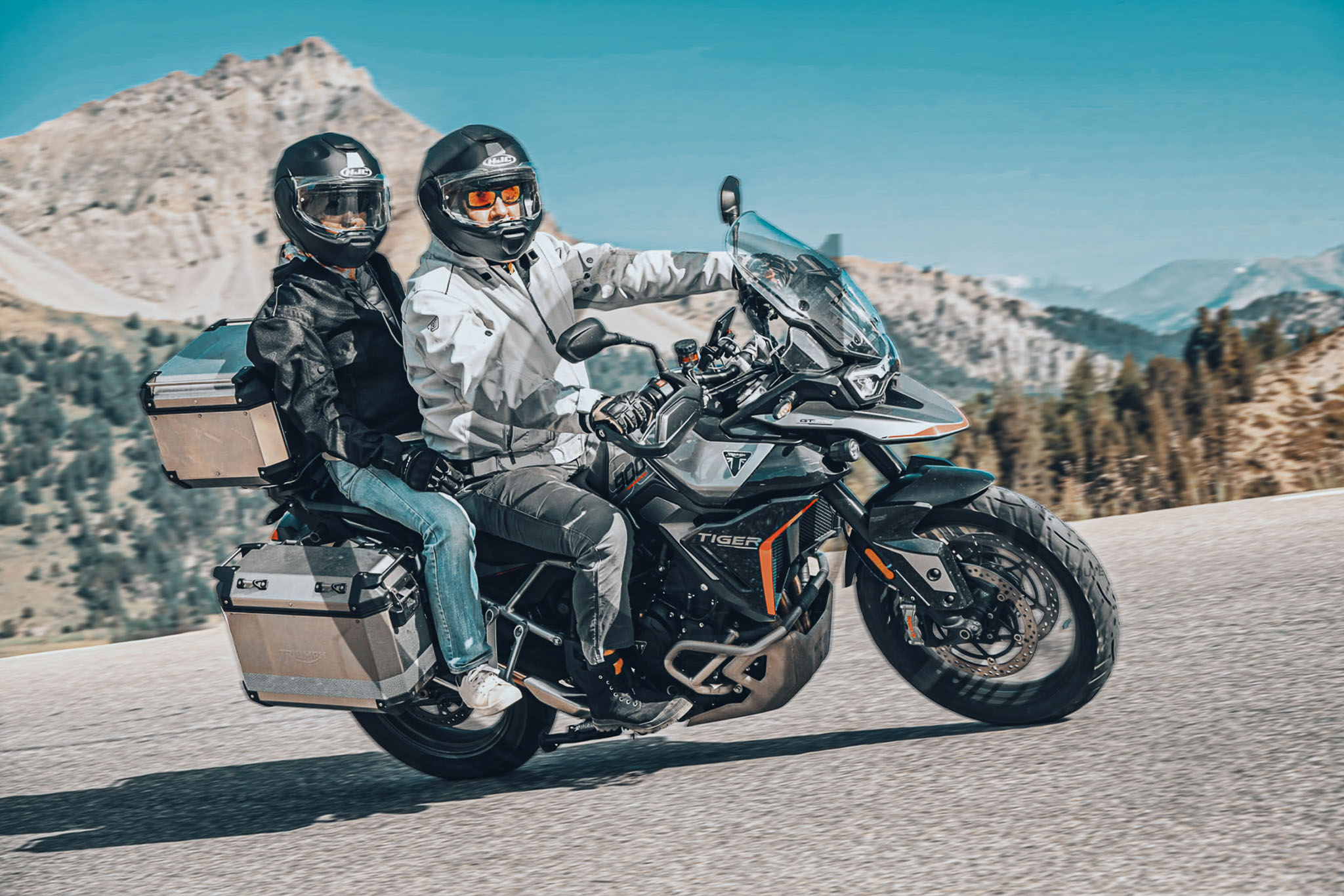
| Drone spot | None marked | Bike | Triumph Tiger 900 |
Practical Information
| Route | Port Camargue → Arles → L'Isle-sur-la-Sorgue → Monieux → Séderon → Laragne-Montéglin → Serre-Ponçon → Embrun → Briançon → Col d'Izoard → Guillestre → Barcelonnette → Colmars → Saint-André-les-Alpes → Aups → Port Camargue |
| What is not in the numbers | Day 2 before 13:40 (about 50 km), the second half of Day 3's map line, and Days 4 and 5, which are shown as planned routes. |
| Altitude | The Col d'Izoard (official 2,361 m) is the high point of the trip. Pack a warm layer and waterproofs: June storms in the mountains build quickly. |
| How the numbers work | Distance, speed and climbing come from the GPS track. Ride time excludes stops of five minutes or more, and climbing is smoothed, so treat it as an estimate. Day 3 uses the tracking app's own summary. |
| 🏍️ | The Izoard first thing in the morning was the right call: we were at the top within 45 minutes of leaving Briançon, before the traffic. Keep the afternoon flexible: mountain weather in June can turn fast, as the Orage!!! pin at Colmars on our map reminds us. |
JavaScript is required to view this gallery.
| ← Previous rideArdèche & Lyon by Motorcycle — May 2026 | Next ride →Our 2026 Motorcycle Season — Every Ride from Port Camargue |